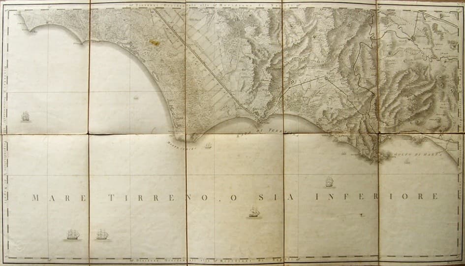
Terra di Lavoro: Gaeta - Antique Map by Rizzi Zannoni, 1804
Original antique geographic map of the Gaeta district, Terra di Lavoro, part of the large map of the Kingdom of Naples by Rizzi Zannoni, published between the late 1700s and early 1800s. Original engraving by Giuseppe Guerra from the Topographic Office of Naples, directed by Rizzi Zannoni, dated 1804. Mounted on canvas in sections for easy transport. Dimensions: approximately 55x96 cm. Other geographic maps of the Kingdom of Naples available upon request.
Related works
- Alessandro Mastrovalerio: Composition, 1952Engravings · Prints · Maps
- Alessandro Sanquirico: Engraving 'Mario a Minturno', Late 1700s/Early 1800sEngravings · Prints · Maps
- Alfredo Bortoluzzi: Engraving 'Lovers', 1940Engravings · Prints · Maps
- Antique Lithograph by Jules-Alexandre Grün, 1909Engravings · Prints · Maps